- Client
- Faculty of Mathematics and Natural Sciences, Institut Teknologi Bandung
- Location
- Bandung, West Java
- Product
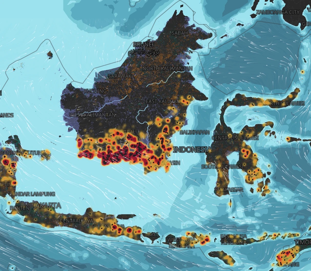
- Thematic maps
The need
Forest and land fire research works with large, complex data. The patterns are hard to see from numbers alone.
What we built
Im.Carto made the maps for the team's research, showing this data clearly.
The result
Patterns in complex data became easy to see.
“The maps from Im.Carto helped our forest fire research a lot. They made patterns in complex data easy to see.”
 Dumaria, M.Sc., Ph.DProfessor, Institut Teknologi Bandung